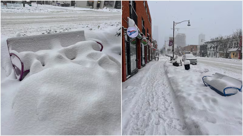
People in southern and eastern Ontario are digging out from the second major snow storm in a week.
Up to 25 centimetres of snow fell today across the province, prompting Environment Canada to issue a number of winter storm warnings and snow squall watches, which are now slowly coming to an end as conditions gradually improve.
Visibility in several parts of the province, notably regions outside of the GTHA, continues to be reduced and the national weather agency is asking people to consider postponing non-essential travel for the time being.
Vincent Sferrazza, Toronto’s director of operations and maintenance, warned that Sunday’s snowfall will see crews plowing for days.
“This is going to be one of those events where we will have to visit all the roads, all of the cycling infrastructure and sidewalks multiple times,” he told CP24.
“So, they’ll be servicing all of the infrastructure throughout the weekend and into the early week.”
0 of 41


Here’s a live breakdown of what you need to know as the heavy snow tapers off heading into the evening.
7:30 p.m. Winter storm may be over, but conditions ‘less than ideal,’ says OPP
Ontario Provincial Police Sgt. Kerry Schmidt says while the snowfall may have tapered off, much work remains to be done to clear roads following this latest wallop of winter weather that has hit much of the province.
Speaking with CP24’s Beatrice Vaisman on Sunday evening, Schmidt, of the Highway Safety Division, said the plows have been out “diligently” and OPP officers have been working hard to respond to more than 200 crashes and 150 vehicles stuck in the snowbanks and ditches.
“And who knows how many more people got themselves stuck to spun around and were able to right themselves as well, so it has been very busy,” he said.
“We are so slowly getting back to some normalcy, but there is still a lot of snow, and, you know, mess to deal with. Even though the snow may be done, the conditions still are certainly less than ideal.”
Schmidt said collisions due to the storm were relatively minor in nature, even with a few rollovers and jackknife tractor trailers, on roadways patrolled by the OPP. He added that there were also no major roads closures.
“So traffic is moving. Traffic volume was certainly a lot lighter today, being a holiday or being a weekend versus the storm we had on Wednesday, Thursday,” he said.
For the most part, drivers faced challenges on ramps and inclines as the snow accumulated as well as some white-out conditions, that in some cases quickly developed, Schmidt said. Freezing and icy patches continue to be a concern on the roads, he said.
Motorists are urged to keep a firm grip on the steering wheel and pay close attention to their surroundings if they encounter icy rod conditions, especially when the lighting is not ideal.
“Don’t panic. No aggressive steering, no aggressive braking. Look in the direction where you want to go, steer in that direction, but don’t panic,” Schmidt said.
“But again, you know, try to prevent yourself from getting there in the first place by going at a speed that’s appropriate, that allows you to slow down, change lanes or stop, depending on what you’re being presented in front of you.”
Lastly, Schmidt urged drivers to stay off the roads so that the snowplows can do their job and if you go out to be mindful of vulnerable road users, like cyclists who may not have protected bike lanes and pedestrians who are navigating and sometimes forced off snowy sidewalks.
“So again, just keep your head on a swivel and just watch out and take care,” he added.
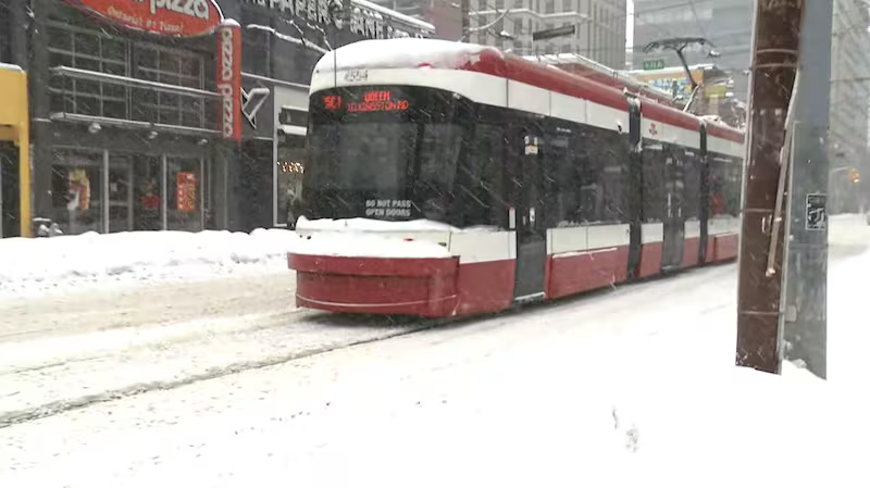
6:11 p.m. Weather affecting service on TTC’s Line 1
Weather conditions are impacting service on Line 1, says the TTC, and as a result there is no service between Eglinton and Bloor-Yonge stations. Shuttle buses are operating.
Due to weather conditions impacting service on Line 1, there is no service between Eglinton and Bloor-Yonge stations. Shuttle buses are operating.
— TTC Customer Service (@TTChelps) February 16, 2025
For up-to-date info, subscribe to MyTTC e-Alerts, follow @ttcnotices, and check the Live Service Alerts on: https://t.co/BvCIj1XtlQ pic.twitter.com/IHf2T0BDsG
5:43 p.m. OPP responds to 200 crashes, 150 cars in ditch in last 24 hours
The Ontario Provincial Police say they’ve responded to approximately 200 collisions in the GTHA as well as 150 reports of vehicles stuck in the snow over the last 24 hours.
Police are reminding drivers to “take care and stay safe.”
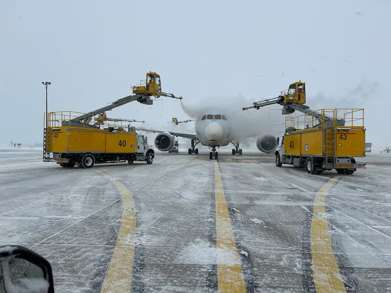
5 p.m. Almost 150 planes deiced today at Toronto Pearson
Crews at Toronto Pearson had a busy day recovering from the snow dump.
As of 4 p.m., 144 aircraft went through the airport’s world-renowned Central Deicing Facility.
Check out more shots of the team in action during today’s snowstorm.
1:09 p.m. York Regional Police issue warning for Lake Simcoe
Police in York Region are urging people to exercise “extreme caution” if they’re planning to venture out onto Lake Simcoe.
“Zero visibility and deep snow are impacting travelling by foot, Snowmobile, ATV/UTV’s on Lake Simcoe,” York Regional Police’s marine unit said in a post on X.
Police are asking residents to consider downloading the service’s “What3Words” app in case of an emergency and assistance is needed.
1:01 p.m. 311 requests on hold due to weather conditions
The City of Toronto is reporting all 311 requests are currently on hold. Officials say “to check the status” of snow plows in your area, visit the city’s site PLOW-TO.
Due to current weather conditions, 311 requests are currently on hold. To check the status of snow plows in your area, please visit https://t.co/vgCJY7biOx pic.twitter.com/HIK2Pz3RKg
— City of Toronto 🇨🇦 (@cityoftoronto) February 16, 2025
12:53 Environment Canada warns 5 to 10 cms of snow expected this afternoon
Now that the heaviest period of the snowfall is over, officials at Environment Canada say residents across the GTHA can expect as much as 10 centimetres this afternoon.
They also warn that people should “consider postponing non-essential travel until conditions improve.”
12:30 p.m. TTC reports ‘residual delays’ across entire subway network
In an interview with CP24’s Lindsay Biscaia, TTC spokesperson Adrian Grundy says the network is currently experiencing several delays and detours as a result of this mornings snowfall.
“Motorists please, if you can avoid being out on the road today, avoid it if possible,” he said.
Grundy adds that due to “heavy snow buildup” there’s no service on line 2 between Woodbine and Kennedy stations as well as no service on line 1 between Bloor-Yonge and Lawrence stations.
“On the street we are all hands on deck, clearing snow as much as we can, plowing and sending out salt trucks out,” he said. “We are seeing lots of delays particularly on the street car network.
12:15 p.m. All Toronto Library branches are closed
The City of Toronto has announced that all Toronto Library branches will be closed due to “heavy snowfall.”
In a post to X, they say this notice will remain in effect throughout the long weekend.
Service Update 🚨
— City of Toronto 🇨🇦 (@cityoftoronto) February 16, 2025
All @torontolibrary branches are closed today due to heavy snowfall. They will remain closed tomorrow as planned for Family Day. pic.twitter.com/0zwQ2wQaJY
12:03 p.m. Toronto Pearson battling snow with ‘over 100 pieces of specialized equipment’
Crews at Pearson airport are continuing to battle leftovers of this mornings snow dump, as they report accumulations of 19.2 centimetres of snow so far.
In a timelapse video posted to X, they say they’re working “around the clock” operating “over 100 pieces of specialized equipment.”
Today’s numbers bring their total count of snow to over 60 centimetres since last weekend.
Wondering what 15 minutes of snowy action looks like from the airfield? Here you go!
— Toronto Pearson (@TorontoPearson) February 16, 2025
This timelapse video was taken around 11 a.m. Check out the flurry of activity behind-the-scenes, and that’s just one section of the airport!
With over 100 pieces of specialized equipment in… pic.twitter.com/9FQr2fGpSd
12:00 p.m. Metrolinx experiencing ‘minor delays’ across network
As a result of the winter weather, Metrolinx is reporting several delays across their network, mostly impacting GO transit buses and train lines.
Officials tell CTV News Toronto, that they are “running modified GO Train service” to keep trains clear of snow and ice build-up.
“There have been minor delays reported across most of our train lines as a result of the weather,” spokesperson Andrea Ernesaks wrote in a statement.
“Currently, GO Buses are most impacted by the weather largely as a result of municipal road conditions with delays of up to 30 minutes on some routes.
For Lakeshore West customers, GO trains that are normally scheduled to start, or end, at Oakville will not run, she noted.
“During these service adjustments, trains will continue to run every 30 minutes between Union Station and Oakville GO. There is no change to regular service for customers between Bronte and Niagara Falls.”
For Lakeshore East customers, GO train service will be modified to run every 30 minutes between Union Station and Durham College Oshawa GO.
11:30 a.m. OPP warns drivers to ‘avoid unnecessary travel’
In an interview with CTV News Toronto, OPP Sgt. Kerry Schmidt described current weather conditions as “treacherous” adding that drivers should stay off the roads.
“Avoid unnecessary travel, wait for the system to pass and wait for the plows to clear the highways,” he said.
“The road conditions are not ideal and you need to have your full headlighting system on and make sure your vehicle is clear of ice and snow.”
Schmidt says he expects traffic volume to build throughout the day but is reminding all drivers that weather conditions can suddenly change at any point.
10:30 a.m. A look at Yonge Street and Albertus Ave
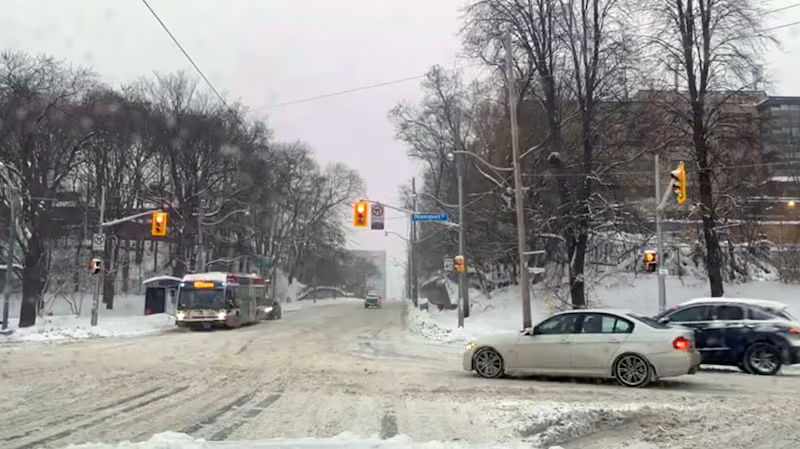
10:07 a.m. A look at Bathurst and Davenport
9:40 a.m. Toronto Hydro confirms one outage in Midland and Finch area
As heavy snow continues to fall, officials at Toronto Hydro tell CTV News Toronto one customer in the Scarborough area is experiencing a power outage.
“We’re currently experiencing one small outage, affecting one customer in the Midland and Finch area. Crews are on-site making repairs,” they wrote in an email.
Officials noted that they were unable to confirm if the outage is weather related but emphasized crews are working “quickly and safely as possible.”
9:35 a.m. Dozens of Pearson flights cancelled
According to Pearson Airport, as of 9:35 a.m., 25 per cent of departing flights are cancelled and 10 per cent are delayed.
As for arrivals, 28 per cent are cancelled and 20 per cent are delayed.
Crews are currently on site working to clear snow.
Melting some of the over 12 cm of snow that fell over the last 24 hours!
— Toronto Pearson (@TorontoPearson) February 16, 2025
At the airport, we have three fixed melters and three portable melters to help keep critical areas clear of snow. pic.twitter.com/LDbaePDLu3
9:05 a.m. City of Toronto warns not to park in designated snow routes
The City of Toronto is once again reminding drivers not to park along designated snow routes, as fines can range between $75 and $200.
Vincent Sferrazza, the city’s director of transportation services, previously stated last week that over 1,500 parking tickets were issued during Thursday’s snowfall cleanup.
In a post to X, the city released photos of what signs drivers can look out for to avoid being ticketed.
A Major Snowstorm Condition is in effect for Toronto. ❄️
— City of Toronto 🇨🇦 (@cityoftoronto) February 16, 2025
Do not park where you see temporary, orange no-parking signs or on roads designated as snow routes.
Parking on these routes is prohibited and vehicles will be tagged at the owner’s expense.
Visit https://t.co/iRLNH07Fsg. pic.twitter.com/uJVKh8Uy1B
9:01 a.m. Over 50 cm of snow at Pearson Airport this week
Officials at Toronto Pearson International Airport say since snow began yesterday, they’ve had 12.2 cm of snow as of 8 a.m. They expect an additional 15 cm today.
“In total, we’ve had 53.6 cm of snow this past week. To put that into perspective, that’s more than the 47.6 cm we got in January, December, and November, combined,” they wrote in a post to X.
The snow is still falling at the airport.
— Toronto Pearson (@TorontoPearson) February 16, 2025
Since it started yesterday, we've already had 12.2 cm of snow accumulate as of 8 a.m. The latest forecast shows we could see an additional 15 cm today.
In total, we've had 53.6 cm of snow this past week. To put that into perspective,… pic.twitter.com/BjU02zmbVI
The city also clarifies that designated snow are “mainly located in the downtown core and include all streetcar routes."
9:00 a.m. Rideshare drivers advised to ‘be patient’
In a statement to CTV News Toronto, George Wedge, the president of the Ontario Rideshare Drivers Association is asking any Uber/Lyft drivers who will be on the roads today to “be patient.”
“Road conditions are horrible but a lot of our drivers are sticking it out to provide service where needed. We ask riders to be patient. Safety is the priority,” he wrote.

8:30 a.m. No TTC service between Woodbine and Kennedy
The TTC is warning riders that there will be no service between Woodbine and Kennedy due to “weather conditions.”
Shuttle buses are on the way, officials noted.
7:09 a.m. Warming centres will remain open
The City of Toronto announced that warming centres will remain open today.
The five locations are 136 Spadina Rd, 81 Elizabeth St, 12 Holmes Ave, 885 Scarborough Golf Club Rd and 55 John St., Metro Hall.
An additional location at 870 Queen St. E. (Jimmie Simpson Recreation Centre) has also opened.
#CityOfTO Warming Centres remain open today. Walk-ins welcome.
— City of Toronto 🇨🇦 (@cityoftoronto) February 16, 2025
📍 136 Spadina Rd.
📍 81 Elizabeth St.
📍 12 Holmes Ave.
📍 885 Scarborough Golf Club Rd.
📍 55 John St., Metro Hall
Find locations and daytime drop-in programs across Toronto: https://t.co/oZMiq6ipLl pic.twitter.com/u5ck0e3iVU
6:30 a.m. How are transit officials responding to the storm?
Adrian Grundy, senior communications advisor for the TTC previously shared the shared the agency’s plan ahead of Sunday’s snow.
He said the TTC will be running storm after service ends to keep tracks free of snow and ice. Subway trains will also be stored underground instead of in the yards.
Grundy said crews are clearing snow and ice to ensure the streetcar overhead power is working.
The TTC also said there will also be 56 bus stops expected to remain out of service because they are mainly located in hilly areas. This will remain until Sunday evening.
Additionally all express routes will operate as local bus service with the exception of the 900 Airport Rocket and the 927 Highway 27 Express.
Due to the weather, all stops listed: https://t.co/EkJVtPhHVs have been taken out of service until further notice. Signs are posted at each location describing where the closest in-service stop is located. We appreciate your understanding during these adjustments. pic.twitter.com/JWHW4OhxvV
— TTC Customer Service (@TTChelps) February 15, 2025
5:00 a.m. A look at Sunday’s forecast
The daytime high for Sunday will be -4 C with a wind chill near -14.
Environment Canada says snow will be mixed with “freezing drizzle” early this morning before snow tapers off in the evening. Officials warn there could still be a 60 per cent chance of flurries tonight.
4:24 a.m. Environment Canada issues winter storm warnings, snow squall watches
Hazardous winter conditions are expected as a “highly impactful winter storm” is set to hit much of the province today.
Between 15 and 25 centimetres of snow is expected to fall throughout the day with the heaviest snow expected this morning and afternoon.
Visibility will be “significantly reduced,” especially in heavy and blowing snow conditions and travel will be hazardous and is not recommended, the natinal weather agency says.
Conditions are expected to rapidly deteriorate this morning as a more significant area of snow and blowing snow arrives.
Among previous warnings, the national weather agency is asking people to “consider postponing non-essential travel until conditions improve.”
Environment Canada is also calling for snow squalls with total accumulations between 30 and 60 centimetres in several regions near Lake Huron and Georgian Bay on Sunday evening.
The national weather agency says the highest amounts are possible if a snow squall remains stationary over a given location, adding that heavy and blowing snow can cause near zero visibility and drifts. These conditions could significantly reduce visibility and make driving hazardous.
“Near blizzard conditions in squalls cannot be ruled out,” Environment Canada said.
The exact positioning of these lake-effect snow squalls is uncertain and it is not immediately known which regions will receive the highest amounts.
This is a developing news story... check back here for live updates
With files from CP24’s Bryann Aguilar